8 Easy Fall Hikes in Vermont with Incredible Foliage Views
You do not need to haul a heavy backpack up a 4,000-foot peak or hike for six hours on the Long Trail to see the best of Vermont in the fall.
In fact, some of the most memorable views in the state take less than an hour of easy walking. Across Vermont, you will find gentle gravel carriage paths, wooden boardwalks over wetlands, and short trails under two miles that lead straight to open mountain ledges.
These walks give you a massive reward for very little effort. You get the sweeping views of red and orange valleys, quiet ponds reflecting the leaves, and roaring gorge waterfalls without wearing yourself out.
Whether you are walking with kids, carrying camera gear, or just want a quick morning walk before stopping for warm cider donuts, here are 8 easy fall hikes that show off the best autumn colors in Vermont.
Quick Comparison: 8 Scenic Beginner Trails
| Hike & Region | Distance | Elevation Gain | Key Highlight |
|---|---|---|---|
| 1. Mount Philo (Champlain Valley) | 2.0 miles loop | 636 ft | Lake Champlain & Adirondack panoramic vista |
| 2. Barnes Camp Boardwalk (Stowe) | 1.4 miles loop | 350 ft | Smugglers' Notch cliff walls & wetland colors |
| 3. The Pogue & Mount Tom (Woodstock) | 2.2 miles loop | 420 ft | High carriage road, reflective pond, village overlook |
| 4. Sunset Rock (Stowe Village) | 1.0 mile round-trip | 210 ft | Historic Stowe church steeple & valley vista |
| 5. Quechee Gorge Trail (Quechee) | 1.3 miles round-trip | 160 ft | 165-foot bedrock canyon & river basin views |
| 6. Texas Falls Nature Trail (Hancock) | 0.4 miles loop | 60 ft | Glacial chutes, footbridge, forest color |
| 7. Mount Olga Fire Tower (Wilmington) | 1.8 miles loop | 520 ft | Southern 360-degree fire tower panorama |
| 8. Bingham Falls (Stowe) | 0.5 miles round-trip | 150 ft | 40-foot gorge waterfall framed by yellow birches |
Route Map: Trailhead Locations Across Vermont
Vermont Easy Fall Hikes Map
1. Mount Philo: Champlain Valley
- Trailhead: Mount Philo State Park, Charlotte
- Distance: 2.0-mile loop (or drive right to the top)
- Difficulty: Easy to moderate
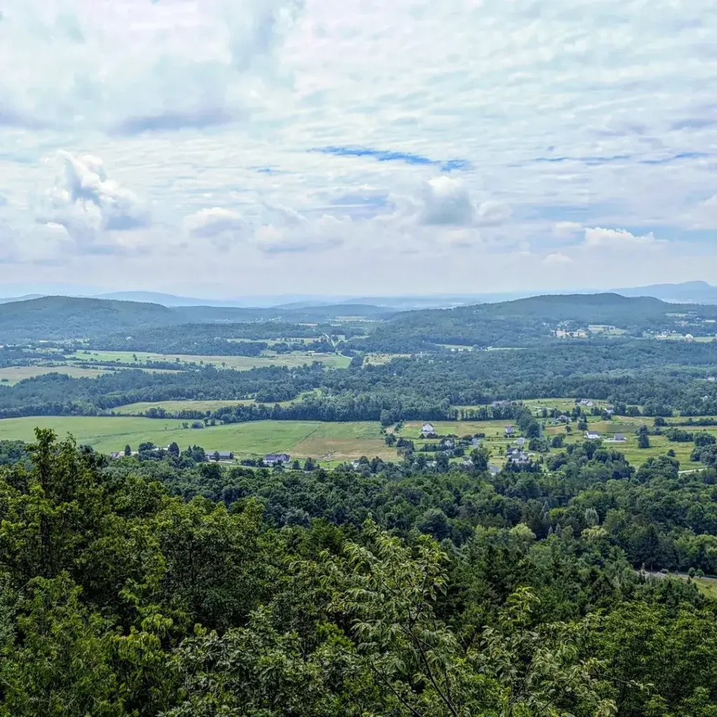
Mount Philo was Vermont’s very first state park, and it is still one of the most rewarding stops in the Champlain Valley.
The trail climbs steadily under tall sugar maples and white pines using wide stone steps. When you reach the top, the trees open up to flat grassy areas and stone walls looking straight out over Lake Champlain and New York’s Adirondack Mountains.
If anyone in your group does not want to walk, a narrow paved road runs up the other side of the hill, so you can drive right to the summit picnic area and enjoy the exact same view.
2. Barnes Camp Boardwalk & Loop: Stowe

- Trailhead: Route 108, Smugglers’ Notch
- Distance: 1.4-mile loop (or an easy 0.3-mile out-and-back on the boardwalk)
- Difficulty: Very easy
Barnes Camp sits right at the entrance of Smugglers’ Notch, giving you a front-row seat to dramatic mountain scenery without any hard climbing.
A wide wooden boardwalk stretches across an open beaver wetland. As you walk out, you look straight up at the giant 1,000-foot granite headwalls of the Notch rising above the trees.
If you want to stretch your legs a bit more, follow the easy dirt loop across a small wooden footbridge through the woods before heading back to your car.
3. The Pogue & Mount Tom: Woodstock
- Trailhead: Prosper Road or Faust Road, Woodstock
- Distance: 2.2-mile loop
- Difficulty: Easy
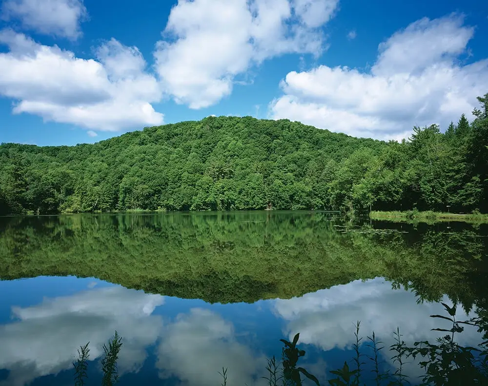
Located inside Marsh-Billings-Rockefeller National Historical Park, this walk follows wide gravel carriage roads rather than rocky, muddy mountain paths. The gentle grade makes it very easy on your knees.
The trail winds under old hemlock and maple trees up to The Pogue, a quiet 14-acre pond tucked high in the hills. In autumn, the surface of the water acts like a mirror for the bright red and gold trees lining the bank.
From the pond, take the short, flat path out to South Peak. You will find wooden benches sitting on a rock ledge looking directly down over Woodstock’s village green, church steeples, and red brick homes.
4. Sunset Rock: Stowe Village

- Trailhead: Sunset Street, Stowe Village
- Distance: 1.0-mile round-trip
- Difficulty: Easy
Sunset Rock is a peaceful neighborhood trail that starts right behind Main Street in Stowe.
A gentle dirt path winds through birch trees and ferns up to a flat stone ledge. From the top, you get a clean view looking down over the village, framing the famous white spire of the Stowe Community Church with Mount Mansfield in the background.
Late afternoon is the best time to do this walk. The golden evening sun lights up the village rooftops and makes the trees across the valley glow.
5. Quechee Gorge Trail: Quechee
- Trailhead: Quechee Gorge Visitor Center, Route 4
- Distance: 1.3 miles round-trip
- Difficulty: Easy
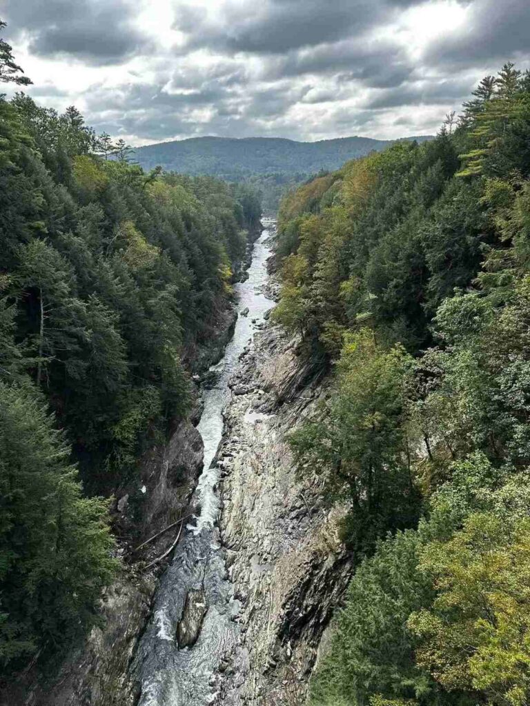
Quechee Gorge is known as Vermont’s Little Grand Canyon, dropping 165 feet down into the bedrock.
Most people just lean over the Route 4 bridge to look down, but the wide gravel walking trail along the rim is well worth your time. It slopes gently downhill through shaded hemlock woods all the way to the water’s edge.
At the bottom, you can sit on giant, flat river stones, listen to the water rush through the chasm, and look up at the colorful trees lining the cliff walls.
6. Texas Falls Nature Trail: Hancock
- Trailhead: Texas Falls Road (just off Route 125), Hancock
- Distance: 0.4-mile loop
- Difficulty: Very easy
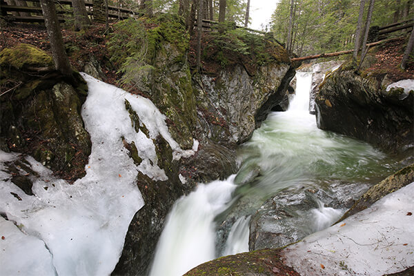
Tucked away in the Green Mountain National Forest, Texas Falls is one of the prettiest water stops in central Vermont.
This short path crosses a sturdy wooden footbridge right above a rushing mountain brook. Over thousands of years, the cold water has carved smooth, rounded potholes and narrow stone chutes into the rock.
The trail stays cool and shaded under the trees, and the loop is short enough for any walking pace. It is the perfect leg-stretcher if you are driving across the mountains on Route 125 or Route 100.
7. Mount Olga Fire Tower: Wilmington

- Trailhead: Molly Stark State Park, Route 9
- Distance: 1.8-mile loop
- Difficulty: Easy to moderate
If you are spending time in southern Vermont, Mount Olga gives you huge views without a grueling climb.
Starting from the state park campground, the trail goes up through quiet woods along a wide dirt path. At the top sits a historic steel fire lookout tower.
Climb the wooden tower stairs to get above the treetops. On a clear fall day, you can look out across rolling ridges stretching into New Hampshire and Massachusetts.
8. Bingham Falls: Stowe
- Trailhead: Route 108, Stowe
- Distance: 0.5 miles round-trip
- Difficulty: Easy (with a rocky section at the end)
Bingham Falls is a classic stop between Stowe Village and Smugglers’ Notch.
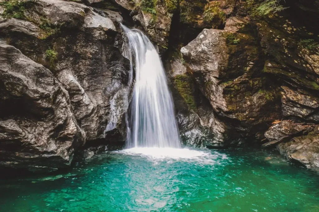
The trail starts as an easy, flat stroll through tall pine trees before dropping down toward the river. A natural stone staircase brings you down into the gorge, where a 40-foot waterfall drops straight into a clear turquoise pool.
The mist from the water keeps the moss on the rocks bright green, which looks amazing against the yellow birch leaves floating on the water. Just take your time on the bottom steps, as they are often damp and slick!
Tips for Fall Walks in Vermont
FAQs
What is the easiest mountain summit to reach in Vermont?
Mount Philo is the easiest by far. You can walk up the short 1-mile trail with stone steps, or simply drive your car straight up the paved state park road to the picnic tables at the top.
Can I bring my dog on these trails?
Yes, dogs are welcome on all 8 of these walks. Keep them on a standard leash to protect local wildlife and give other walkers plenty of space.
When do these trails hit peak fall color?
High-elevation northern trails like Barnes Camp and Bingham Falls in Stowe usually peak first, between late September and the first few days of October. Lower valley walks like Mount Philo, Quechee Gorge, and Mount Tom in Woodstock peak a little later, between October 7 and October 15.
Getting out on foot is the best way to experience Vermont’s fall colors. You do not need to tackle steep cliffs or spend the entire day hiking to find unforgettable scenery.
Lace up a comfortable pair of shoes, grab a warm drink, and take your time enjoying the trails.